


- Project Resources
- Documents and Publications
- E-Mail Updates
- Contact Us
- Lane Closures

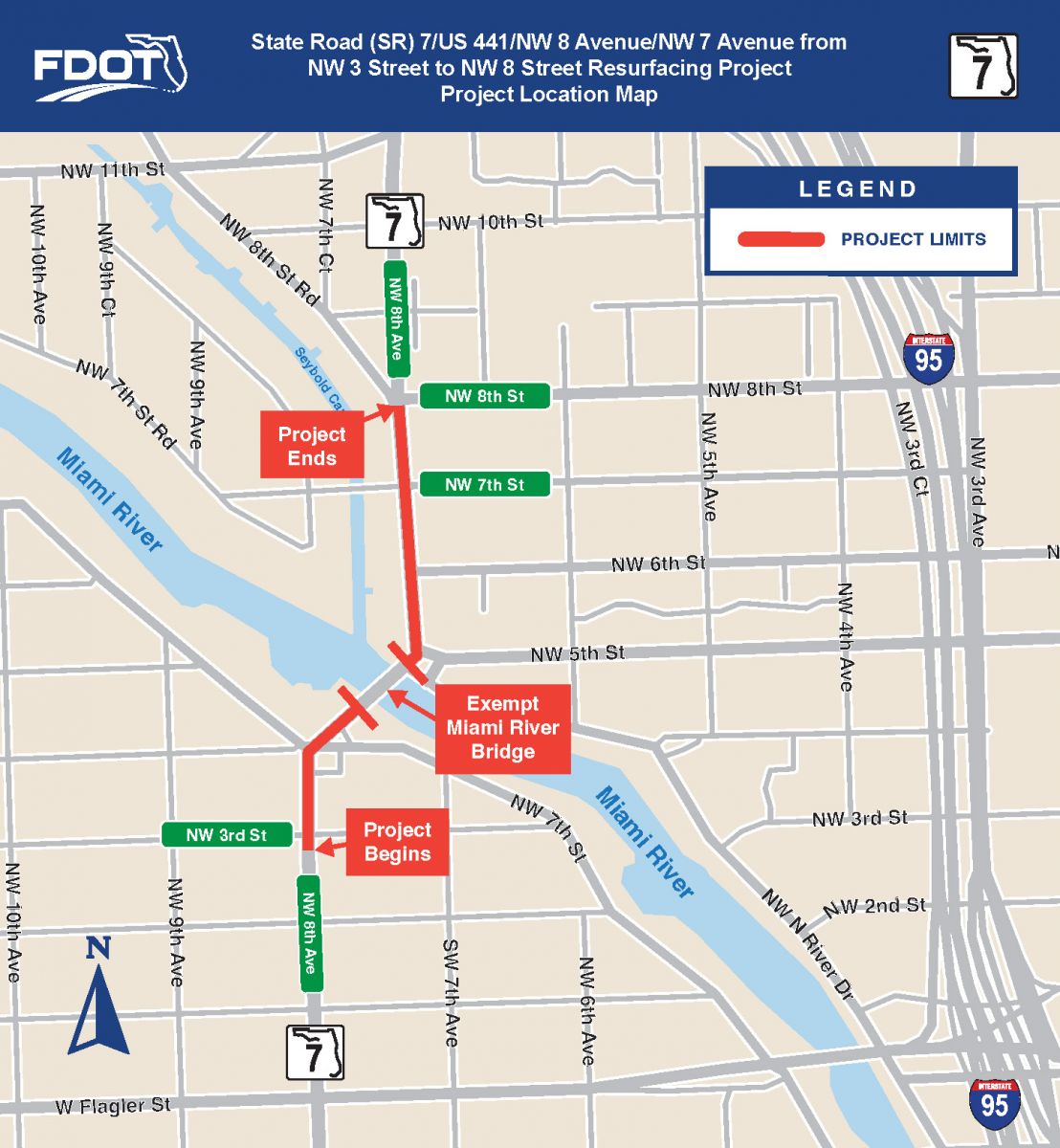
The Florida Department of Transportation (FDOT) is scheduled to begin a roadway project the week of October 6, 2025, along SR 7/NW 8 Avenue/NW 7 Avenue from NW 3 Street to NW 8 Street in Miami-Dade County.
FDOT COMPASS
FDOT is committed to ensuring the State’s infrastructure serves residents, businesses, and visitors to meet their current and future transportation needs. Benefits of this project include:
.png)
COMMUNITIES
-
Reconstructing concrete sidewalks and curbs and gutters
-
Providing signalized pedestrian crosswalks in school areas

SAFETY
-
Upgrading pedestrian signage and signalization
-
Installing traffic signals at various locations
-
Installing high-emphasis crosswalks
RESILIENCY
-
Repaving and restriping the roadway

SUPPLY CHAIN
-
This project invests in roadway facilities to maintain the movement of goods and services our community and beyond

TECHNOLOGY
-
Installing traffic detection sensors and video cameras
-
Upgrading existing street lighting to LED (Light-emitting diode) technology

WORKFORCE DEVELOPMENT
- This project creates opportunities for contractors resulting in positive economic benefits for workers and the community
LANE CLOSURE INFORMATION
Work will be done in phases to reduce the effects of construction on the community.
Lanes can be closed during the following hours
Weekdays, nights and weekends:
- 9:30 a.m. to 1 p.m.
- 6:30 p.m. to 6:30 a.m.
Access to businesses and residences will be maintained. Pedestrian and vehicular detours will be established with clear signage. Lane closure information is posted weekly on the department's website, www.southflroads.com.

| Start Date |
|---|
| October 2025 |
Est. Completion |
| Spring 2026 |
Construction Cost |
| $1.94 million |
Lengths and Limits |
| From NW 3 Street to NW 8 Street |
Community Outreach Specialist |
| Annabella Vizcaino Quest Corporation of America C: (786) 510-6113 Annabella.Vizcaino@dot.state.fl.us |
