

SFL Roads / Buffered/Protected Bicycle lanes on SR A1A/MacArthur Causeway
Buffered/Protected Bicycle lanes on SR A1A/MacArthur Causeway

Where?
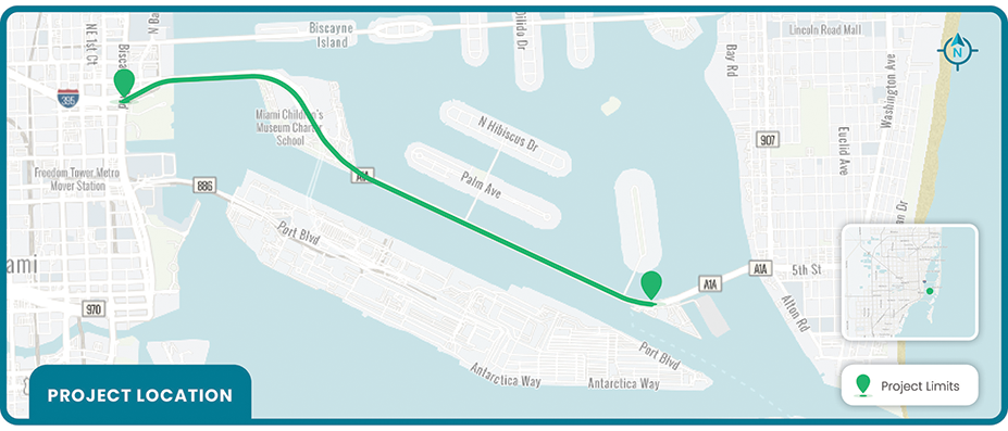
SR A1A/MacArthur Causeway from Biscayne Bay to Terminal Isle
Areas of Interest
Miami/Miami Beach
Project Stage
Design
FID Number
443432-2-52-01
Length
2.7 miles
What FDOT is Doing
Design enhanced bicycle faciliities along Causeway.
Purpose
To improve bicycle facilities between the City of Miami and Miami Beach.
Schedule
Design: 2025
Construction: 2028
Final Recommendation
Provide enhanced bicycle lanes (striped buffer, delineators, profiled thermoplastic, green markings) where feasible.
Project Documents
For more information on FDOT's Bicycle Pedestrian Mobility Improvement Program, please contact
Shereen Yee Fong at Shereen.YeeFong@dot.state.fl.us
© 1996-2024 Florida Department of Transportation